Welcome to the AI4NGOs Platform
- 00902126217973
- İstanbul, Türkiye
- info@ai4ngos.org

Welcome to the AI4NGOs Platform

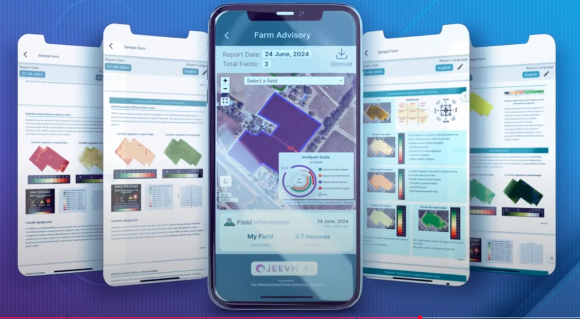
| AgriSense (Farmonaut) is a smart platform that leverages satellite imagery and artificial intelligence to analyze crop health, monitor soil conditions, measure moisture levels, and forecast agricultural risks such as drought and salinity. The platform delivers precise data through mobile applications and a web interface, allowing farmers and agricultural organizations to make data-driven decisions to boost productivity and reduce waste. Operating in more than 15 countries and serving hundreds of thousands of users, AgriSense is a valuable solution for supporting food security in rural and crisis-affected areas. |
In humanitarian contexts—particularly in areas affected by conflict or disasters such as Gaza—AgriSense is a vital tool for enhancing food security. The platform enables NGOs and farmers to remotely monitor crop conditions, reducing the need for costly and risky field visits. Its data supports identification of high-need farmlands, optimal allocation of scarce resources like water and fertilizer, and early detection of crop stress. Additionally, the tool aids climate adaptation programs by offering predictive analytics that ensure sustainable agricultural practices. AgriSense's data can also be integrated into other monitoring systems, improving the efficiency of humanitarian response and enabling evidence-based decision-making.
AgriSense offers highly accurate satellite analysis with wide coverage across millions of hectares. It generates detailed reports on plant health, soil fertility, and moisture levels, along with early warnings for agricultural risks. The tool is accessible via mobile and web, with API integration for use with external systems. It supports multiple languages, making it globally accessible. It empowers timely, informed decisions in challenging environments like conflict zones or climate-impacted regions. The platform helps reduce input costs, minimize crop losses, and promote long-term food security. Its data-driven approach also supports sustainability and environmental monitoring.
Requires stable internet access, which may be limited in remote areas. Subscription fees may be a barrier for small organizations. Users need initial training to interpret satellite data. Weather conditions like heavy cloud cover can affect data clarity.
Starting from $50–100/month for small-scale use; varies based on project size and required features.
Without AgriSense, organizations risk relying on field surveys alone, increasing costs and delays. There may be missed early signs of drought or crop stress, resulting in resource misallocation and reduced food security outcomes.