Welcome to the AI4NGOs Platform
- 00902126217973
- İstanbul, Türkiye
- info@ai4ngos.org

Welcome to the AI4NGOs Platform

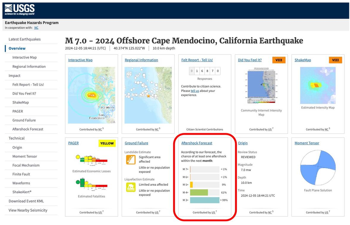
The USGS Earthquake Hazards Program is a program of the United States Geological Survey that monitors seismic activity and provides scientific data on earthquakes and their hazards. It provides maps, real-time reports, and seismic hazard assessments. The program is used to support rapid response efforts and emergency planning in earthquake-prone areas.
Humanitarian organizations use USGS Earthquake Hazards Program data to plan earthquake disaster responses and identify priority areas for relief. The program helps prepare hazard maps and assess communities' vulnerability to earthquakes to support preparedness and disaster mitigation efforts. It also contributes to the design of emergency plans, distribution of supplies, and management of evacuation operations based on accurate scientific seismic data.
Provides real-time and accurate earthquake data, hazard maps, immediate alerts, and technical support to disaster agencies.
Users need earthquake data interpretation skills to make the most of the provided analyses.
Free
Without the tool, earthquake response planning becomes slower and less accurate, putting lives at risk.